Saturday, June 8, 2019
Spring Runoff in Rock Canyon, Wasatch Front, Provo, Utah
There are 25 photos in this post. The mountains of Northern Utah have received double the amount of snow and rainfall during the early part of 2019. The normally dry lower part of Rock Canyon, near Provo, Utah, is flooding the normally dry roadways and creating spectacular rapids and small waterfalls.
This photo is near the mouth of the Canyon.
The trail up the Canyon is usually quite busy. You can easily see why it is called Rock Canyon.
This is a device to measure the water flow. Usually, at this point, if there is any water, it is just a trickle.
While you are walking up the trail, you can hear the rocks in the creek rolling and crashing. It sounds like distant thunder.
People hiking up the Canyon have certain distance markers. This is known as the big rock.
We have lived in Provo for five years (with one year spent in Annapolis, Maryland) and this is only the second time we have seen the Creek running and never this high.
The sides of the canyon are very steep and there are many places that are frequented by rock climbers. This is a talus slope. It makes for very difficult climbing.
Where the streambed is narrow, there is an almost constant low rumble from the rocks being moved down the Creek.
The Creek is narrow in places, but quite deep and the sound of the water is a low roar.
As you walk up the Canyon, the vegetation changes from scrub oak to aspens and pines.
This is the first bridge.
The water here is normally clear, but the runoff is so large that it is eroding the banks of the usually small stream at this point.
This is the second bridge.
Compared with the flow of rivers across the United States, this is not too impressive. But when you are used to a trickle of water, it sounds and looks impressive.
This is an old cement covered water ditch that used to carry water for homes and irrigation down the Canyon. The Canyon supplies about 15% of the water used by Provo but almost all of it is piped from springs up near the head of the Canyon.
The rock formations are impressive.
It is hard to imagine the forces in the earth could bend rocks like you can see in the above image.
I took this photo from the third bridge but didn't get a photo of the bridge.
Here is the fourth bridge. Time to turn around and go back down the Canyon.
View from the fourth bridge.
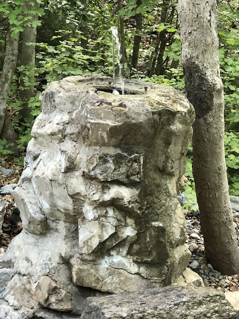
A welcome drinking fountain on the way up or down. Vandals had broken the fountain earlier in the year but the Provo Department of Water Resources fixed it in time for summer.
Parts of the trail used to be paved and at the bottom of the Canyon, some of the trails are still paved. The trail is clean and there are some picnic and restroom facilities at the trailhead. Part of the Canyon is under the jurisdiction of the National Park Service and part is owned by the Provo City. The Rock Canyon Preservation Alliance has a Conservation Easement on some of the land at the mouth of the Canyon. Although Provo City claims the entire Canyon, it is jointly claimed by the National Forest Service. The lower part of the Canyon is heavily used by hikers, mountain bikers, rock climbers and picnicers.
Because of the Canyon's proximity to Provo City and the usually dry vegetation, open fires are prohibited. One challenge of the Canyon is the number of dogs. During this walk up the Canyon, I counted 17 dogs and 7 of them were not on leashes.
This is the first gate area next to a small parking area. The current parking is inadequate and spills over into the adjoining neighborhoods. We live approximately 300 yards from the mouth of the Canyon.
Subscribe to:
Post Comments (Atom)


No comments:
Post a Comment