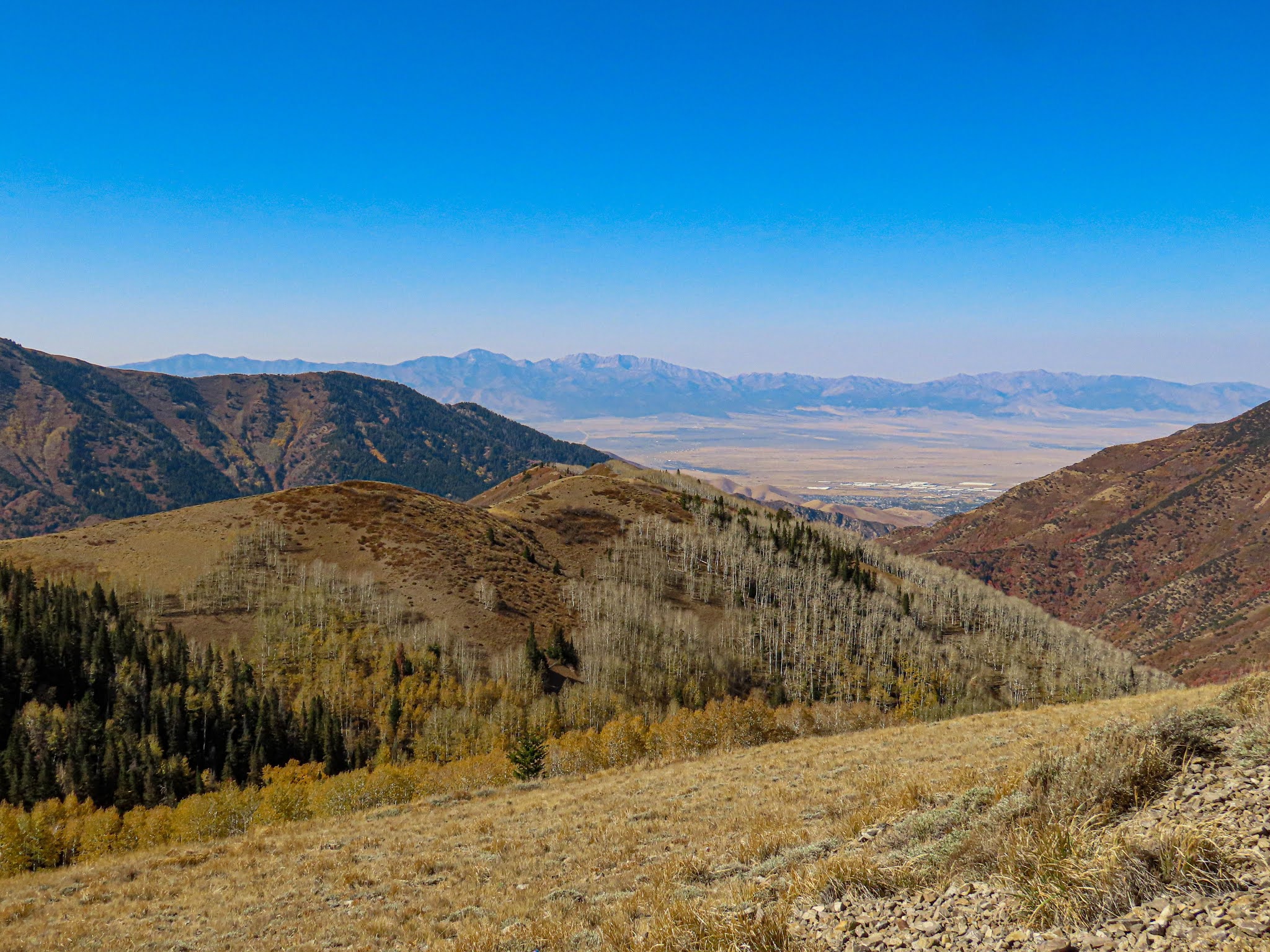
Saturday, October 17, 2020

Shoreline of Utah Lake


 Both Utah Lake and the Great Salt Lake in Utah are remnants of the huge Lake Bonneville the largest Late Pleistocene paleolake in the Great Basin of western North America. Quoting from Wikipedia: Lake Bonneville,

The Western Interior Seaway preceded Lake Bonneville. Lake Bonneville was a pluvial lake that formed in response to an increase in precipitation and a decrease in evaporation as a result of cooler temperatures. Lake Bonneville covered much of what is now western Utah and at its highest level extended into present-day Idaho and Nevada. Many other hydrographically closed basins in the Great Basin contained expanded lakes during the Late Pleistocene, including Lake Lahontan in northwestern Nevada.

Here in Utah Valley, we live right next to the "Bench" which is really the old shoreline of Lake Bonneville. Here is some further explanation about this huge lake from the article cited above:

Lake Bonneville was not a “proglacial” lake, although it did form between about 30,000 and 13,000 years ago when glaciers at many places on Earth were expanded relative to today during the last major glaciation. For most of its existence (that is, during the transgressive plus regressive phases) Lake Bonneville had no river outlet and occupied a hydrographically closed basin. Changes in lake level were the result of changes in water balance caused by climate change (a simplified version of the water-balance equation is inputs equal outputs plus-or-minus storage changes). Storage changes are equal to volume changes, and changes in volume are correlated with changes in lake level. When inputs (i.e., precipitation; runoff in rivers) were greater than outputs (i.e., evaporation from the lake surface; evapotranspiration in the basin), lake level rose, and when outputs were greater than inputs, lake level fell. Changes in global atmospheric circulation led to changes in the water budget of Lake Bonneville and other lakes in the Great Basin of western North America. Mountain glaciers in the Bonneville drainage basin stored less than 5% of the water that Lake Bonneville held at its maximum, so that even if all the mountain glaciers in the basin melted at once and the water flowed into the lake (this didn't happen—it took thousands of years for the mountain glaciers to melt, and Lake Bonneville was falling by that time), it would have had little effect on lake level. Lake Bonneville had no river connection with the huge North American ice sheets. While Lake Bonneville existed the patterns of wave- and current-forming winds were not significantly affected by the Laurentide and Cordilleran ice sheets in northern North America.

Friday, October 16, 2020

Fall on the Provo River Parkway Trail


Fall is a beautiful time along the Provo River Parkway Trail. There are mature to very old trees all along the river and the leaves are spectacular. There are a few footbridges over the river in addition to the many streets that also cross the river. The trail goes under the major streets but the footbridges (bicycles also) are picturesque. 

Wednesday, October 14, 2020

Red Bell Peppers


These are one of my staple foods. We mostly eat them on salads but from time to time we have stuffed Bell Peppers. Here is our family's recipe website: Family Heritage Recipes. You can search for recipes that include Bell Peppers. 

Tuesday, October 13, 2020

Detail from the Joseph Smith Memorial Building in Salt Lake City, Utah


 This is a detail from the Joseph Smith Memorial Building in Salt Lake City, Utah. This building is located on South Temple Street right across the plaza to the east of the Salt Lake Temple of The Church of Jesus Christ of Latter-day Saints. The Joseph Smith Memorial Building was previously used as a hotel called the Hotel Utah but today it is a reception center and office building for the Church with two very good restaurants. Unfortunately, the building is closed except for employees during the pandemic. 

Monday, October 12, 2020

Photos of the Salt Lake City, Utah Temple Renovation


This is a series of photos taken on October 9, 2020, of the renovation of the Salt Lake City, Utah Temple of The Church of Jesus Christ of Latter-day Saints. This first photo shows the complete demolition of the buildings on the north side of the temple including the former annex building. You can't see the buildings because they are gone. If you look at the left side of the photo you can see one of the doors to the temple with the staircase. It is about ten feet or so above the ground showing how much of the fill has been excavated and showing the foundation of the temple.


This photo shows the scaffolding around the spires of the temple. 

This is the east side showing the doors and the excavation now showing the foundation of the temple more clearly. 


This photo shows the southeast corner of the temple and shows more of the excavation and removal of the landscape and the Visitors Center building on the south of the temple lot. 

Moving around to the southwest side of the temple you can see more of the lot with the landscaping and building structures removed. 


This is more of the southwest side of the temple. 

For more information about the reconstruction and renovation see, "First six months of Salt Lake Temple renovation reveal the project’s enormity."

Sunday, October 11, 2020

Looking Over into Tooele Valley


At 9,015 feet above sea level, this may be the highest road in the mountains around the Salt Lake Valley and Utah Valley. This photo was taken from the Bingham Mine Overlook or the Bingham Canyon Overlook depending on what you read. It is one of the few places you can drive to that gives you a view of the Tooele Valley just west of the Salt Lake Valley. 

Saturday, October 10, 2020

Bingham Canyon Copper Mine, Utah


This is the Bingham Canyon Copper Mine in the Oquirrh Mountains on the west side of the Salt Lake Valley, Utah. It is impossible to even begin to comprehend the size of the mine. If you click on the photo and zoom in, you can see the dots that are huge mine trucks almost twenty feet tall. This photo was taken from the Copper Pit Overlook on a very high ridge looking over the mine. The access road to the overlook is barely passible for a regular car but not impossible for a four-wheel-drive, high clearance vehicle. I drove our Subaru Outback up the road without a problem. Here is a short explanation of the mine from Wikipedia: Bingham Canyon Mine.

The Bingham Canyon Mine, more commonly known as Kennecott Copper Mine among locals, is an open-pit mining operation extracting a large porphyry copper deposit southwest of Salt Lake City, Utah, in the Oquirrh Mountains. The mine is the largest man-made excavation, and deepest open-pit mine in the world, which is considered to have produced more copper than any other mine in history – more than 19 million tons. The mine is owned by Rio Tinto Group, a British-Australian multinational corporation. The copper operations at Bingham Canyon Mine are managed through Kennecott Utah Copper Corporation which operates the mine, a concentrator plant, a smelter, and a refinery. The mine has been in production since 1906, and has resulted in the creation of a pit over 0.75 miles (1,210 m) deep, 2.5 miles (4 km) wide, and covering 1,900 acres (3.0 sq mi; 7.7 km2). It was designated a National Historic Landmark in 1966 under the name Bingham Canyon Open Pit Copper Mine. The mine experienced a massive landslide in April 2013 and a smaller slide in September 2013.